Friday 07th July 2017
We parked up
near a lake called Shiroka Poliana Dam late on Thursday night. The TET goes
right along the southern side of this as it heads east towards the end of the
Bulgarian part of the trail. Our plan was to retrace our steps back towards
Yakoruda on Friday.
Friday
dawned, another blue sky day, so we were up early and away having figured out a
way to rejoin the trail by traversing the northern shore of this lake and
heading upto Goyam Beglik Dam, which then had a large piste that would take us
to the TET trail. The initial part of the trail was straight forward with
simple piste and easy navigation, as we got nearer to the Goyam Dam, the trail
deteriorated to single track, winding through the forest.
We had a
couple of moments of retracing our steps, I nearly got pulled off my bike by
some barbed wire which had wrapped around my gear lever, Lucy saw it and
shouted which saved an off! We eventually came out at the tarmac road, (37)
which crossed to the next part of the piste. This proved to be really simple
and things were going great guns until we hit the TET!
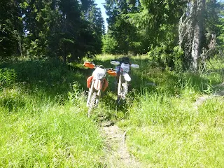
As we turned
north west onto the TET to head towards the col at Polbit Komak, the trail was
clearly an old and very damaged section of forest trail. Heavily washed out,
trees down all over and very over grown. There were a few very steep ups,
plenty of steep downs and all had more of a feel of an enduro day out than a
normal TET day. I think an alternative route might need to be found for this
section??
Once at the
col, we had a coffee and a rest, we decided to turn around here and leave the
section between the col and Yakorunda as it’s about 50 km and we had no idea
what the other sections of the trail would be like getting back to the van.
After
consulting the GPS map for a bit, we found a piste track that joined us back up
near our start point on the TET earlier in the day, so we retraced our steps
back using this. This might prove to be a good alternative for the original bit
so I’ll pass it onto the Bulgaria Linesman when I find out who it is.
The TET heads
down to Sarnitsa, which is a pretty big town on the the Dospat Dam lake. We got
there at lunchtime so we stopped at a lovely little cafe for a drink and some
food. The trail passes through the town, there are fuel stops here too, then
heads around the southern side of the lake. At either end it’s tarmac but the
bit in the middle is piste, long straight and fast!
Once at the
end we rode through Dospat and then onto what turned out to be a fabulous part
of the trail. We left the town road and headed up in to what looked like an
overgrown mess, but there was a stony trail which meandered through lots of
beautiful wild flowers and past some allotment type areas before returning into
the forest. The forest trail was a windy and interesting challenge with lots of
small easy rocky steps and some dried out boggy bits. We passed some busy
forestry guys, who all waved and tooted their horns as we weaved around their
work area, then came to another section that has changed massively. The trail
doesn’t really exist, there seems to be a really steep footpath where the GPX
line goes. It climbs very steeply over rock steps with some good drop off’s
below and disapears into the undergrowth. We bailed on this bit as the day was
getting on. The piste we were on wasn’t on our GPS map, but it’s direction sort
of headed to back to the 37, so we followed this and eventually came out about
5km south of the van parking at the lake. Again a possible change needed to
this bit and this may well be the alternative but it’ll be upto the locals to
confirm that.
All in all, a
really good and eventful day, lots of challenges, loads of variety in the
terrain we’ve crossed and some really lovely people we’ve spoken to en route.
Bulgaria is definately growing on us more and more as we traverse through this
beautiful country.


